Ninety-five percent of British Columbia, including Vancouver, is on unceded traditional First Nations territory. Unceded means that First Nations people never ceded or legally signed away their lands to the Crown or to Canada. A traditional territory is the geographic area identified by a First Nation as the land they and/or their ancestors traditionally occupied and used.
Before beginning an event, meeting, or conference, it is proper protocol to acknowledge the host nation, its people and its land. You may hear someone begin an event by saying something like this:“Before we begin, I would like to acknowledge that we are meeting today on the traditional territories of the ________________ people (or Nation). We thank them for allowing us to meet and learn together on their territory.”
Here is a map of some of the First Nation traditional territories in British Columbia:
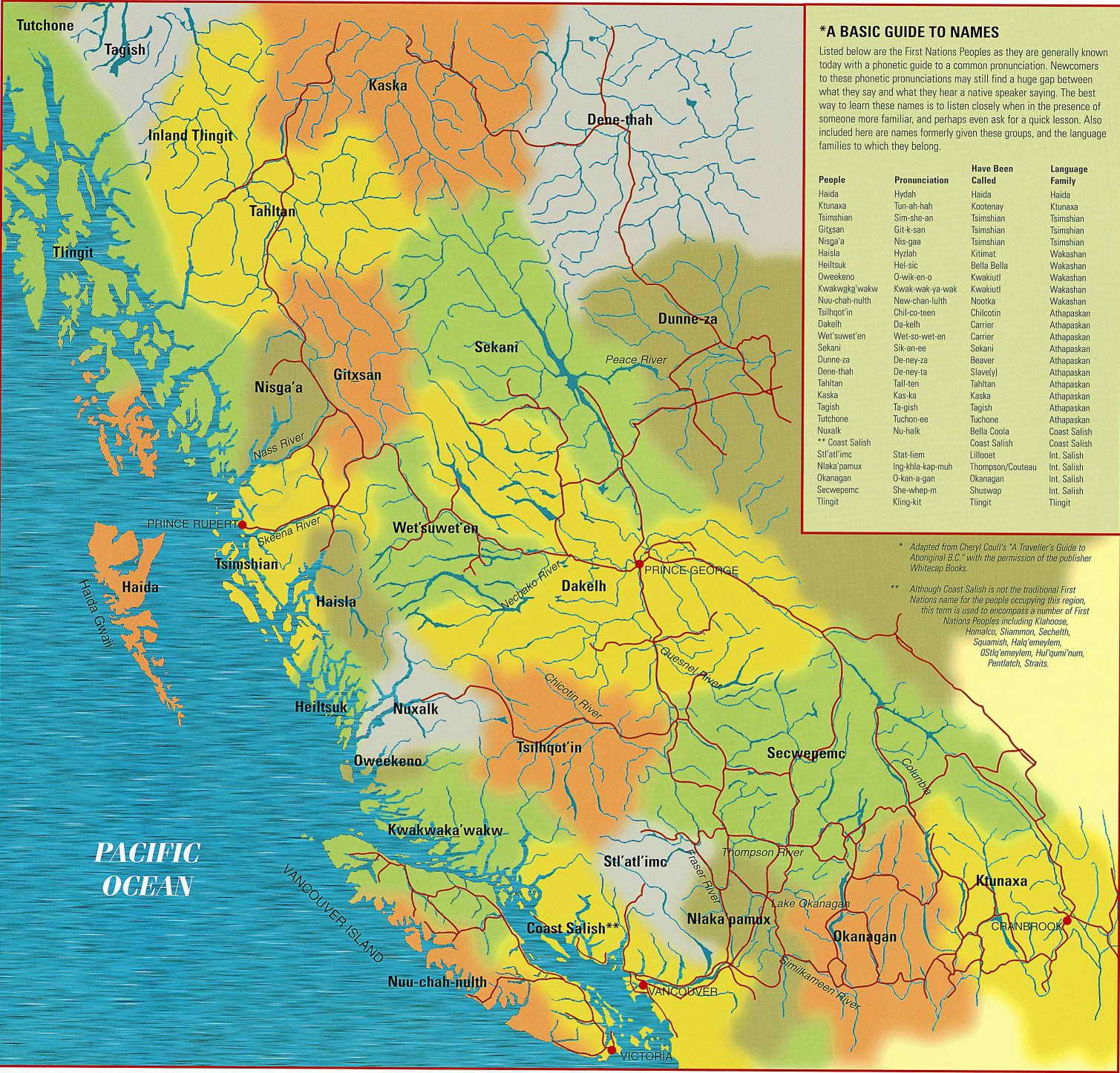
It’s important to note that maps are colonial and political objects, and they can exercise power by what they include and exclude. This map in particular is simplified and incomplete. Many nations are not included, and the map itself implies clear borders between nations, which was often not the case. For example, the Sinixt Nation (whose traditional territories extend across the American border through the B.C. interior and up to north of Revelstoke) is excluded from this map. This is likely because in 1956, the Canadian government declared the Sinixt Nation extinct in Canada, a ruling that members of the Sinixt Nation have been successfully opposing through the court systems (see Indigenous Peoples living in U.S. can claim Aboriginal rights in Canada: Supreme Court and Sinixt Indigenous nation not ‘extinct’ in Canada, Supreme Court rules). Here are some maps compiled by the Sinixt Nation to counter that erasure: Maps – Sinixt Nation.
Wherever you are located, you will need to research how to properly acknowledge the lands you are on. A good place to start is Native-Land.ca or the websites of local nations.
Media Attributions
- Fig 1.6: Map showing First Nations territories in B.C. by the British Columbia Ministry of Education. It is not subject to the Creative Commons license and may not be reproduced without the prior and express written consent of the British Columbia Ministry of Education.